
SLAM
Why is SLAM Important?
The alternative to SLAM is infrastructure-dependent navigation, i.e. floor markers, ceiling barcodes, magnetic tape. All of those require physical installation and are in a fixed position. If you change the warehouse layout you may need to redo the floor guides, which is expensive and slow.
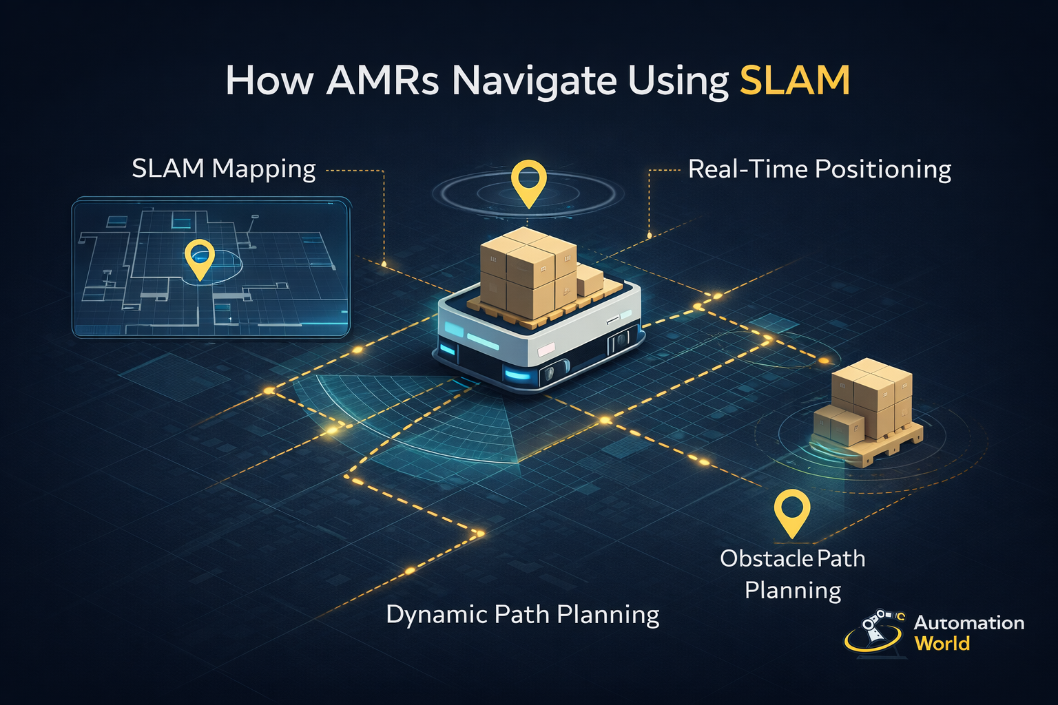
SLAM-based AMRs can adapt to their surroundings. They scan their environment, build a map, and navigate by matching live sensor readings to that stored map. If you rearrange the racking the robot can remap without a significant infrastructure change. That flexibility is one of the main reasons AMRs have become the preferred choice over AGVs for operations that need to reconfigure frequently, operations like third-party logistics providers handling different clients, or distribution centres that adjust layouts seasonally.
Not all SLAM implementations perform equally though. The algorithm quality, sensor quality, and how the system handles a dynamic environment, people, forklifts, temporary pallets, all affect reliability. Ask vendors how their system performs in a busy facility, not just an empty demonstration space.
How Does SLAM work?
During the initial AMR deployment, the robot is driven through the facility while its sensors are collecting data. LiDAR bounces laser pulses off walls, racking, and columns to build a 2D or 3D point cloud. The SLAM algorithm then processes this into a navigable map for the AMR to use, via the Fleet Management Software, going forward.
Once the system is live, the AMR continuously matches incoming sensor readings against the stored map to calculate its exact position. When something new appears, for example a temporary pallet that someone has put down on the floor, a parked forklift or an operator working in the aisle, the robot detects it as an obstacle and routes around it. Persistent changes get incorporated into the map over time so the map is kept updated and fresh.
Most warehouse AMRs use 2D LiDAR, which maps a horizontal plane. Higher-spec systems add 3D LiDAR or depth cameras to detect low objects that 2D sensors might miss. The field of view and range of the sensor set the practical limits of what the SLAM system can work with.
Example Applications
- SLAM is used in virtually all modern AMR deployments. It is most relevant in facilities with high foot traffic, changing layouts or irregular floor plans where fixed-infrastructure navigation would be impractical or too expensive to modify when layouts change.
UK Integrators Offering This Solution


Geek+
Autonomous mobile robots for warehouse and fulfilment operations

Related Application Guides
![Warehouse AMR Guide: Autonomous Mobile Robots UK [2026]](https://automationworld.co/wp-content/uploads/warehouse-amr-300x225.jpg)
Warehouse AMR Guide: Autonomous Mobile Robots UK [2026]
UK warehouses are running out of people and running out of time. The transport and storage sector has recorded some of t…
View Guide
Warehouse Robotics UK: A Buyer’s Guide to Automation Systems
UK warehouse operators continue to face recruitment and retention challenges. Robots don't fix the people problem entire…
View Guide